
Power Line Inspection Methods: Drones vs. Helicopters vs. Ground Capture
Helicopter, drone, truck, or smartphone? Each capture method has defensible advantages depending on asset class, terrain, and budget - and none of them decides your inspection ROI on its own.
- Each method has a clear role: drones for transmission and substations, helicopters for long remote patrols, trucks for distribution poles, smartphones for QA, remediation, and gap-fill.
- Drones are the most powerful option. A three-person team can cover 2,000 lattice towers across 250 miles in 30 days, capturing detail no ground-based method can replicate.
- Helicopters inspect at patrol speed and standoff distance - corridor screening, not component detail.
- Truck capture is the backbone of distribution programs, imaging hundreds of poles a day. But ground-level angles and obstructions mean it rarely stands alone.
- Utilities evaluate vendors on cost per usable deliverable, not sticker price per mile. Clean first-pass data wins contracts over cheaper competitors with rework problems.
- Truck-mounted cameras: speed and scale for distribution networks
- Smartphones and handheld cameras: flexible capture for targeted work
- Helicopter inspection: patrol speed for long corridors
- Drone inspection: the standard for utilities
- Drones: the most powerful capture method (when the data quality is there)
- What does drone power line inspection cost?
- Side-by-side comparison
- Data quality decides inspection ROI, not capture method
- How a capture-agnostic platform fixes your pipeline
- Frequently asked questions
But the choice of camera only accounts for half the problem. The other half is what happens to 50,000 photos after the crew leaves the field and whether any of those photos are even usable or actionable.
The inspection process that turns raw imagery into reliable findings, detailed reports, and prioritized work orders depends entirely on data quality, not camera quality.
First, let’s cover each capture method at a high level.
Truck-mounted cameras: speed and scale for distribution networks
For high-volume distribution pole inspections along accessible roadways, truck-mounted camera systems offer something other methods struggle to match: continuous data capture at driving speed with no flight permits, no eminent physical risks, and no weather-related standdowns.
A single truck can image hundreds of poles in a day, making it the most cost-effective method per structure for distribution-scale programs.
Detect's own vehicle unit, built over ten months of field prototypes, now averages 1,000+ distribution poles a day at road speed, with each frame bound to its pole record as it is taken.
Where truck capture falls short
The tradeoffs are physical. Truck-mounted cameras shoot from ground level, which means you're looking up at every structure.
Angles on crossarms, insulators, and top-of-pole hardware are limited. Trees, buildings, and other obstructions block line of sight on a meaningful percentage of structures in any given corridor.
And for taller distribution assets or anything requiring hardware-level detail, the resolution from street level often falls short of what an analyst needs to make a confident determination.
Truck capture works well as the backbone of a distribution inspection program, but it rarely stands alone. The gaps it leaves, from obstructed views to insufficient detail, typically need supplemental capture from another method.
Smartphones and handheld cameras: flexible capture for targeted work
Smartphones and handheld cameras are an extremely versatile capture option in the field. Not because they're the best at anything, but because they're available everywhere, cost nothing extra, and require zero specialized training.
Best use cases for handheld capture
Post-construction QA is a strong fit. A crew finishing a repair or installation can photograph completed work with a phone, and that image immediately becomes part of the asset record if the back-end system supports it.
Remediation verification works the same way: before-and-after documentation captured on site, linked to the structure, available for audit.
Substation walkthroughs, targeted close-ups on flagged components, and supplemental angles on structures that truck or drone capture missed are all practical applications. The visual data capture happens in real time with no mobilization cost.
Where handheld capture breaks down
Image quality varies by device, lighting, and operator. There's no standardized shot list or angle protocol unless one is enforced externally. And scaling smartphone capture across a 200-mile corridor is unrealistic. Handheld capture supplements a program. It does not replace one.
Helicopter inspection: patrol speed for long corridors
Before drones, helicopters were aerial power line inspection - and for some jobs they still fit. A crewed patrol can cover a long transmission corridor in hours, which keeps helicopters in the rotation for storm damage assessment, comprehensive patrols on remote lines, and terrain where ground access is impractical.
Where helicopter capture falls short
The tradeoffs are structural. A helicopter inspects at patrol speed and standoff distance, so it sees the corridor, not the component - a cracked insulator disc or a backing-off cotter key rarely resolves from a moving aircraft. Flight hours are expensive, low-altitude crewed flight carries its own safety exposure, and the imagery often lands as a spotter's notes rather than a structured, per-structure record.
The gap shows up in the findings. On one remote 618-tower audit, helicopter flybys had missed leaning towers and flooded footings that a drone campaign then documented structure by structure. The pattern generalizes: helicopters answer "how does the corridor look," drones answer "which component needs work." Mature aerial utility inspection programs increasingly use the patrol for screening and the drone for detail - and feed both into one record.
Drone power line inspection: the standard for transmission and substations
Today, drone inspection services are the primary data collection method for transmission corridors, substations, and increasingly for distribution networks.
But "using drones" and "running an effective drone program" are two different things. The value of any drone utility inspection depends on what happens to the drone data after capture.
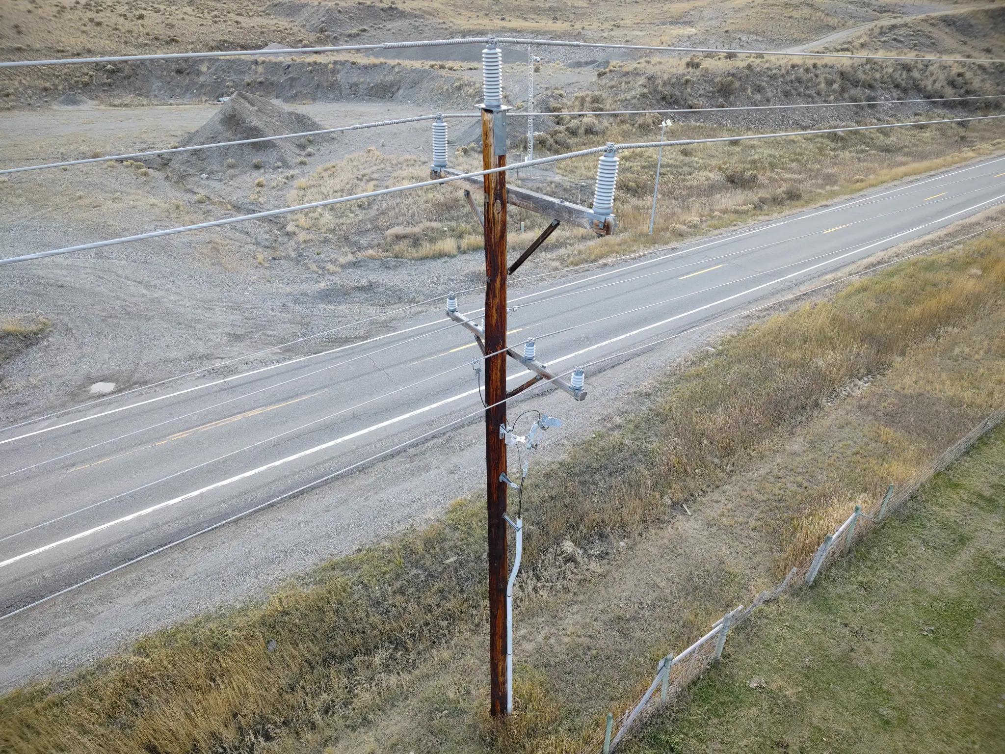
Drones: the most powerful capture method (when the data quality is there)
Inspection drones have become the default for good reason.
A skilled UAV pilot can capture close-range imagery of hardware, insulators, conductor attachments, and foundation conditions from angles that no ground-based method can replicate. No other capture method gives you multi-angle, component-level detail on a lattice tower 150 feet in the air.
The speed advantage compounds the capability advantage. For example, a three-person drone team can cover 2,000 lattice towers across 250 miles in 30 consecutive days, collecting over 100K geo-referenced images.
That kind of throughput would take months with ground patrols or helicopter flyovers using traditional inspections.
Looking deeper: thermal imaging and multi-sensor capture
Thermal cameras mounted on inspection drones can detect overheating components, failing connections, and heat signatures that indicate electrical resistance, surfacing issues long before a visual inspection would catch them. Visual and thermal imagery captured in the same flight gives analysts two layers of data collected from identical vantage points, which makes the detailed analysis significantly more reliable.
For drone powerline inspection specifically, thermal data can reveal splice degradation, connector hotspots, and insulator leakage current patterns that are invisible to the naked eye.
Infrared imaging has become standard on utility inspection campaigns for exactly this reason. The thermal sensors pay for themselves the first time they flag a failing component that would have gone undetected in a visual-only pass.
Some programs are also integrating LiDAR data for vegetation encroachment monitoring and structural wear assessments, adding a third dimension to the inspection data. When combined with high resolution images and temperature data, the result is a comprehensive asset profile that supports both immediate maintenance decisions and long-term proactive maintenance planning.
Drone types and where each fits
Not every drone is suited for every inspection scenario.
Multi-rotor platforms
These dominate transmission and substation work because they can hover, orbit structures, and capture precise angles. But for long linear corridors where coverage speed matters more than close-range detail, fixed wing drones and hybrid drones offer significantly more flight time per battery cycle.
Fixed wing drones
This type covers ground faster and carries heavier sensor payloads, making them a strong fit for wide-area mapping, vegetation surveys, and initial corridor screening. Hybrid drones split the difference with vertical takeoff and fixed-wing cruise, useful in inspection scenarios where teams need both transit speed and the ability to stop and hover at specific structures.
The best drone for a given program depends on the asset type, corridor length, and level of detail required. Many mature drone programs use multiple airframes across different phases of the same campaign.
The complications are real, but they're solvable
FAA regulations, airspace authorization, and BVLOS (beyond visual line of sight) restrictions add planning overhead.
Safety regulations vary by jurisdiction, and utility companies often layer their own requirements on top of federal rules. Weather windows shrink available field days. Flying near energized conductors requires precision that not every crew delivers reliably.
And when structures from adjacent lines sit 100 or 200 meters apart, the data from one flight can easily bleed into another, creating a sorting problem downstream. (For a broader look at how these dynamics are reshaping the DSP landscape, see 2026 trends for drone service providers in utility inspection.)
These are real operational constraints. But the bigger risk for drone operators is data variability across pilots.
When every pilot captures different angles, different distances, and different levels of component coverage, the output can't be processed consistently at scale. Rejected missions and unpaid reflights erode the margins that made the contract worth bidding in the first place.
Utility companies evaluate vendors on effective cost per usable deliverable, not sticker price per mile. A vendor with a higher per-mile rate but clean first-pass data consistently wins contracts over cheaper competitors with rework problems.
Standardizing capture before the first prop spins
This is where structured capture programs change the math. Detect's Data Quality Program, for example, equips DSP partners with 3D digital shot sheets that define every required angle, position, and camera setting before a flight launches.
The program also includes training modules on structure identification, component-level awareness, and standardized hardware assessment, so drone pilots learn to recognize critical infrastructure components in the field rather than relying on post-flight review to catch what they missed.
This way, automated flight paths replace pilot guesswork with repeatable, utility-grade coverage. And integrated QA flags image quality issues while the crew is still on site, so a five-minute re-shoot doesn't become a five-figure reflight. You’ll also learn the ideal workflow between DSP, analytics partner, and utility down how each handoff works.
The result is that every drone pilot, regardless of experience level, captures structured, AI-ready imagery that meets utility standards on the first pass. Certified drone pilots who complete the program deliver consistent inspection data across campaigns, which is what makes drone inspections scalable. Without that consistency, adding pilots just scales the problems.
None of the complications above disqualify drones. When the data quality foundation is in place, drones are the single strongest tool available for transmission-scale inspection, substation overviews, and any asset that demands multi-angle hardware detail.
What does drone power line inspection cost?
Mature programs price drone power line inspection per structure, not per mile. On that axis drones sit in the moderate band of the comparison below: below crewed helicopter flight hours, above a truck pass on accessible distribution roads.
The State of Utility Drone Inspections 2026 report runs the math on a typical transmission contract: bid at $40 per structure for 5,000 structures, that is $200K gross against $150K of direct costs, a $50K margin before rework. At a 20% rework rate the effective margin falls to $20K, and across the contracts in that report 15-25% of delivered imagery needs remediation before utility QA or AI analytics can use it.
Throughput sets the denominator. The three-person team above covered 2,000 lattice towers across 250 miles in 30 days; a three-person crew imaged 96 wooden H-frame structures in a single day. The per-structure rate a power line inspection company quotes only means something next to its structures per crew-day and its first-pass acceptance rate.
So ask any vendor for three numbers before comparing bids: structures per crew-day, first-pass acceptance rate, and the reflight policy on fixed-fee work. A higher per-structure rate with clean first-pass data costs less per usable deliverable than a cheaper bid that absorbs a fifth of its imagery as rework.
Side-by-side comparison
While every capture method has a role, none of them win across every dimension. This comparison breaks down where each one fits and where it falls short, so you can match the right tool to the right asset class.
Data quality decides inspection ROI, not capture method
This is where the conversation usually stops. Teams pick a capture method, run the inspection, and hand off a hard drive, memory card, or cloud photo storage link. Then the real problems start.
The association problem
Consider what drone inspections of a single transmission corridor produce: tens of thousands of images, each tagged with a GPS coordinate and a structure ID. In the inspection data Detect processes, roughly 8 out of 10 GPS tags are off by enough to cause sorting errors downstream.
Sometimes it's off by a few meters. Sometimes it's mapped to the other side of the line entirely. And because the drone flies around each structure rather than directly over it, the photos don't cluster neatly around a single point. Adjacent structures, parallel lines, and different takeoff segments all contribute to a jumble of imagery that looks nearly identical to a human reviewer.
The orientation problem
Now try to answer a simple question: which insulator is cracked? Is it the bottom left or middle right? Where's a second angle to confirm?
If you can't associate each photo to the correct structure and then orient it within that structure's geometry, the inspection data is functionally useless regardless of how sharp the images are.
This problem exists across every capture method - helicopter patrols included. Truck-mounted cameras create it with distribution poles that sit close together along the same road. Smartphones create it when different crew members upload photos without consistent metadata.
Even if the capture device changes, the data quality challenge does not.
The image quality problem
A photo might be correctly tagged and properly oriented, but if it's blurry because the camera settings shifted mid-flight or the wind picked up at the wrong moment, it can't support a confident defect determination.
If that image was the one angle that would have revealed a failing cotter key or a loose bolt, the gap in coverage only surfaces weeks later when an analyst flags it. By then, the crew is long gone. Re-mobilization is the most expensive line item in any inspection budget. Repeat inspections caused by poor image quality are the silent margin killer in drone inspection services.
How a capture-agnostic platform fixes your pipeline
The reason these problems persist across the drone industry is that the inspection process has long been designed around a single capture method. Drone companies build data processing software for drone data. Truck inspection firms build workflows around their camera rigs. The data stays siloed by collection method, and the association, orientation, and quality problems get solved manually, if they get solved at all.
Three automated steps before defect detection begins
A platform like DetectOS is the analytics layer that processes imagery from any source, whether drone footage, truck-mounted cameras, smartphone photos, or helicopter capture, with no special equipment requirements and no proprietary formats. From there, you get action-oriented findings to know what your team needs to do.
Photo-to-structure association uses machine learning to map every image to the correct structure ID, even when GPS coordinates are inaccurate. Orientation tracking identifies where on the structure each photo was taken, so analysts can navigate between angles and pinpoint specific components. Image quality assurance flags photos that don't meet the resolution or clarity threshold required for accurate data analysis, and triggers re-capture alerts while crews are still mobile in the field.
Those three steps are the front half of a longer chain. What a clean, associated, quality-gated image stream ultimately buys you is a pipeline from images to work orders - findings validated by experts, ranked by risk, and landed in the systems that schedule crews.
That last point is worth emphasizing. Catching a blurry image the same day it's taken, while the crew is still within range, is the difference between a five-minute re-shoot and a five-figure re-mobilization. That single step in the data processing pipeline is what separates programs that deliver reports on schedule from programs that absorb weeks of rework.
The right question to ask
The debate over drones vs. helicopters vs. trucks vs. smartphones is worth having, but only for about fifteen minutes. Each method has a clear role.
The question that actually determines inspection program performance is whether your data pipeline can ingest imagery from all of them, sort it accurately, and surface findings fast enough to act on them.
If that’s something your team is looking for, let’s have a conversation. DetectOS will take a look at imagery you’ve already collected and uncover what your team may have missed. Request a free asset analysis today.
