
Drone Utility Inspection: RGB, LiDAR, and Thermal Capture Compared (2026 Guide)
What RGB, thermal, and LiDAR each find, the resolution that decides what exists, autonomous drones - and how to pick the package, defect list first.
- The defect you’re hunting picks the sensor - RGB covers most of the defect catalog, thermal finds electrical problems under load, LiDAR measures geometry
- Resolution is the ceiling: sharp imagery left 100% of the 258-type defect catalog assessable; blurry imagery left 7% (Detect Data Quality Program)
- Bad capture is expensive before it’s dangerous: GPS misassociation drives 35% of inspection rework (State of Utility Drone Inspections, 2026)
- Docked, autonomous drones already fly utility BVLOS missions under FAA waivers; the Part 108 rule that would normalize them is still pending as of mid-2026
- Capture is a data decision, not a flight decision - plan from the defect list backward, not from the drone forward
- What is drone utility inspection?
- What sensors do utility inspection drones carry?
- What can RGB visual capture find?
- When do you need a thermal imaging drone?
- What does a LiDAR drone add?
- How are autonomous drones changing utility inspection?
- How do you choose a capture method?
- What happens to the data after the flight?
- Frequently asked questions
What is drone utility inspection?
Drone utility inspection is the capture of high-resolution imagery of poles, towers, conductors, and hardware by unmanned aircraft, so that asset engineers can assess condition without climbing, bucket trucks, or helicopter flyovers. The deliverable isn’t photos - it’s verified findings: which components are degrading, where, and how urgently.
It’s worth separating from a term it often gets tangled with. Drone surveying maps terrain - photogrammetry and orthomosaics for construction, mining, and land development. Drone utility inspection assesses assets. The aircraft may be identical; the mission, sensor settings, and deliverable are not. If a provider quotes you a surveying workflow for an inspection job, the imagery usually can’t answer the questions your engineers will ask of it.
The capture flight is only the first third of the job. What happens before (structure lists, shot sheets, flight plans) and after (QA, upload, classification) decides whether the mission produces usable condition data - our guide to the utility drone inspection workflow walks through all nine steps.
What sensors do utility inspection drones carry?
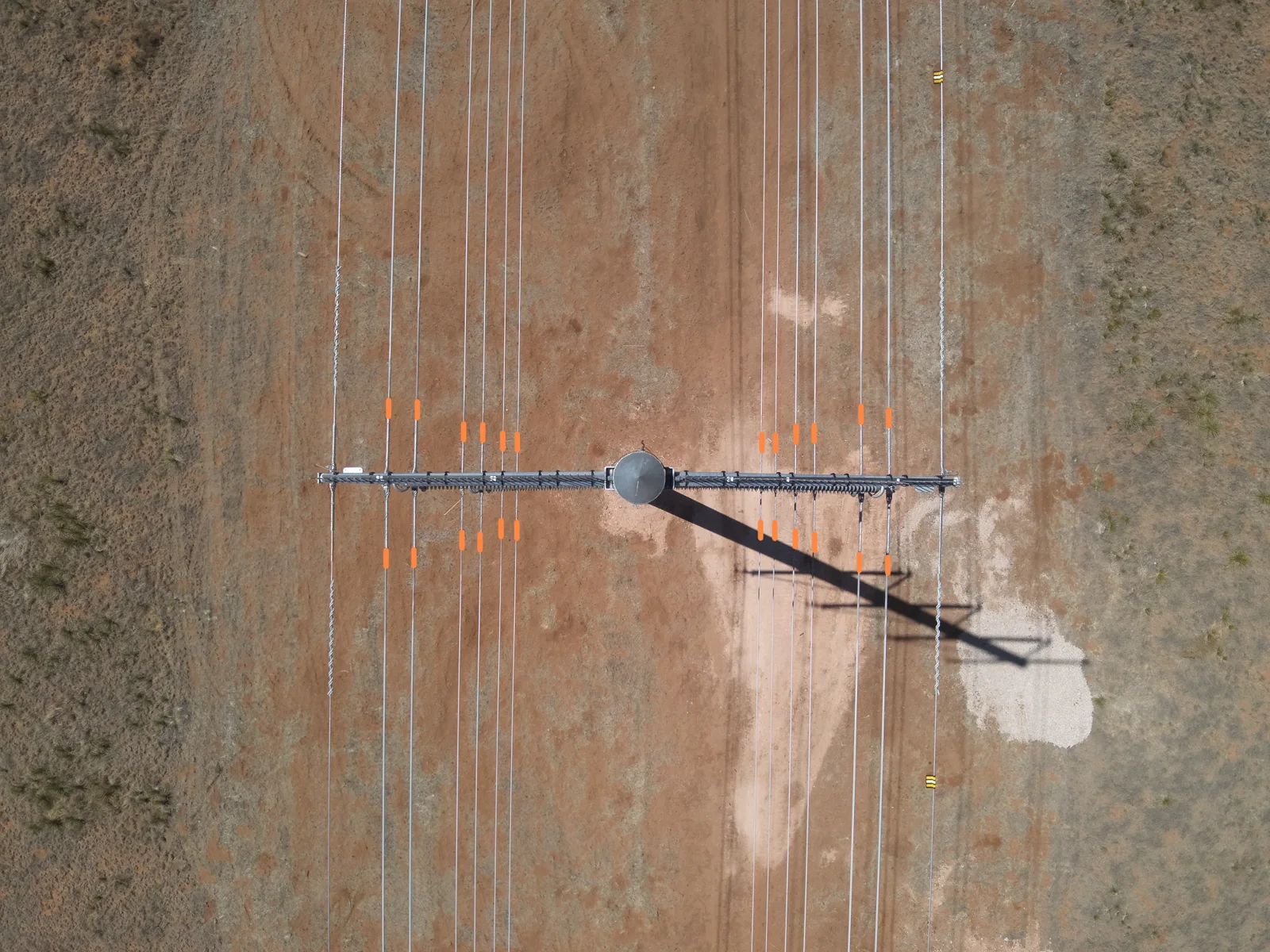
Three sensor families do almost all of the work, and each answers a different question. RGB asks “what condition is this component in?” Thermal asks “is anything running hot?” LiDAR asks “where exactly is everything, and how close?”

Two things stand out. RGB covers most of the catalog on its own - which is why it’s the default. And no sensor sees everything: internal wood decay defeats all three, which is why groundline testing still exists as a separate discipline on utility poles.
What can RGB visual capture find?
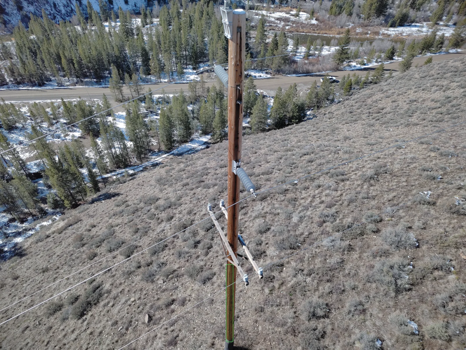
Most of what matters. High-resolution visual imagery is the workhorse of drone utility inspection: corroded and loose hardware, splitting crossarms, chipped insulators, damaged conductor strands, woodpecker cavities, missing cotter keys. In Detect’s transmission defect catalog - 258 condition types across 19 classes - the large majority of findings come from sharp RGB capture.
Small hardware is the proof case. A cotter key is a few grams of bent steel, and a missing one on a strain connection can start the chain that drops a conductor. On one newly commissioned HVDC line, a single flagged clevis bolt - caught in RGB imagery and verified by experts - averted a forced outage worth more than $1 million. That find existed because the capture was sharp enough to resolve it.
What image resolution do utility inspections need?
The number that governs everything is ground sample distance (GSD) - the real-world distance covered by one image pixel (Wingtra). Halve the GSD and every component doubles in pixel detail; fly higher or use a wider lens and detail drains away. The arithmetic is unforgiving: a two-centimeter cotter key photographed at a 2 mm-per-pixel GSD spans about ten pixels - enough for an AI model and a reviewer to judge it. At 10 mm per pixel it’s two pixels: invisible.

This is why capture quality sets a hard ceiling on everything downstream. In Detect’s Data Quality Program analysis, sharp imagery left 100% of the 258-type defect catalog assessable, soft imagery 69%, and blurry imagery just 7%. No software recovers detail the camera never captured.
When do you need a thermal imaging drone?
When the defect is electrical rather than structural. A loose or corroded connection has higher resistance, and high-resistance connections generate heat under load - reliably detectable by infrared inspection (Fluke application note). A splice that looks perfect in RGB can be quietly cooking. A uav thermal imaging camera finds it before it fails.
Two rules keep thermal honest:
- Fly under load. Heat signatures scale with current. A drone with thermal camera flown over a lightly loaded line can miss a connection that glows at peak demand - schedule thermal passes when the line is working.
- Know whether your camera is radiometric. A radiometric thermal camera records a calibrated temperature in every pixel; a non-radiometric one shows only relative contrast (Teledyne FLIR). For trending a connection’s temperature across inspection cycles, radiometric data is the difference between a measurement and an impression.
Know the limits, too. A thermal imaging drone won’t see inside wood - internal pole decay is thermally silent until failure - and solar loading can mask or mimic hotspots. Thermal is a complement to RGB, not a replacement: the strongest programs fly both on the same mission.
What does a LiDAR drone add?
Geometry, not defects. A lidar drone fires laser pulses and builds a point cloud of everything along the corridor; classification software separates ground, vegetation, and conductor points to measure clearances, encroachment, and sag (YellowScan). Questions RGB can only estimate - is that oak inside the clearance envelope, how much has this span sagged since last cycle - LiDAR answers in centimeters.
That makes it the right tool for vegetation management programs, rebuild engineering, and clearance compliance - and the wrong tool to hunt for a loose bolt. LiDAR doesn’t assess component condition. Utilities that fly it typically pair a LiDAR corridor pass with component-level RGB structure capture, on the same campaign or alternating cycles, because the two datasets answer different regulatory and engineering questions.
How are autonomous drones changing utility inspection?
They turn inspection from scheduled campaigns into standing coverage. Docked “drone-in-a-box” systems launch, fly programmed routes, land, and recharge without a crew on site. This isn’t a future capability: the FAA has granted utilities waivers to run docked drones beyond visual line of sight without visual observers - Florida Power & Light’s Percepto deployment is the documented reference case.
The regulatory ground is the thing to watch. Today, Part 107 requires visual line of sight, and flying beyond it takes a Part 107 waiver - granted case by case. The Part 108 rule that would normalize BVLOS operations was proposed in August 2025, but it remains pending: the FAA reopened the comment period in January 2026 to resolve contested right-of-way provisions, and no final rule has been published as of mid-2026. Plan autonomous programs around waivers, not around a rule date.
Autonomous drone technology also sharpens the fleet question - what hardware you’re allowed to fly for utility work. That’s its own moving target; our guides to NDAA compliance and the DJI ban cover it.
How do you choose a capture method?
Start from the defect list, not the drone. The mission exists to answer specific condition questions; the sensor package follows from which questions are on the list. On new builds that mission is construction QA: how utilities inspect a construction site at close-out is the review that RGB at tight GSD exists to serve.
| Mission | Capture package | Why |
|---|---|---|
| Routine condition cycle | High-res RGB, structure-by-structure | Covers most of the defect catalog; feeds the asset register |
| Storm / event response | RGB + thermal | Structural damage plus electrically stressed connections, fast |
| Vegetation & clearance program | LiDAR corridor pass (+ RGB) | Encroachment and sag in measurable centimeters |
| Rebuild / new construction QA | RGB at tight GSD | Component-level baseline before energization |
Drone service providers rework 15-25% of delivered imagery - and GPS misassociation alone drives 35% of it. The image was sharp; it was attached to the wrong pole (State of Utility Drone Inspections 2026).
Then hold the capture to a data standard, because the expensive failures are data failures. Roughly 30% of ad-hoc, unstandardized imagery gets rejected outright. Capture is a data decision: right sensor, right GSD, right structure ID, every time. That’s also why drone mapping conventions from the surveying world - flight lines, overlap ratios - don’t transfer directly to inspection, where the unit of work is the structure, not the acre.
- Write the defect list first - which condition questions must this mission answer?
- Set the GSD spec from the smallest component you must judge.
- Pick the sensor package per mission type - RGB by default, thermal under load, LiDAR for geometry.
- Standardize the capture workflow so every image lands with the right structure ID.
- Verify the data flows into one condition record, whatever captured it.
What happens to the data after the flight?
The sensor doesn’t make data useful - the system it lands in does. A campaign produces tens of thousands of images across drones, helicopters, and ground crews; the work is turning them into one condition record your engineers can act on.
That’s the layer DetectOS occupies. It ingests imagery regardless of what captured it - drone, helicopter, or a lineman’s phone - classifies conditions against the 258-type catalog, and routes findings through the Hybrid AI + Expert Review model: AI screens the volume, utility-trained experts verify every finding before it reaches your queue. The output feeds the same utility asset management record that drives maintenance and replacement decisions, whether the mission was a docked-drone patrol or a transmission inspection campaign. Choosing drone inspection software on that test - what happens to the pixels after they land - matters more than any spec on the aircraft.
Frequently asked questions
What is the difference between drone surveying and drone inspection?
What is a radiometric thermal camera?
Can drones inspect energized power lines?
What image resolution do utility inspections need?
Do utility inspection drones need LiDAR?
What is BVLOS?
Are DJI drones still allowed for utility inspection work?
Ready to see what your capture program is missing?
Get a free audit: we’ll analyze a representative section of your system - whatever sensor captured it - and show you what AI-plus-expert review finds. No strings.
Book a free audit →