
Canadian Drone Pilot Certification for Utility Inspections: From Transport Canada Certificates to a Capture Standard
Every drone pilot certificate in Canada comes from Transport Canada, and none of them says anything about the imagery a pilot brings back. Here is the full certification stack for utility inspection work after the November 2025 rule changes - and the layer that makes data from different crews comparable.
In Canada, utility drone pilots need three layers: a Transport Canada certificate (Basic, Advanced, or Level 1 Complex for lower-risk BVLOS), operator safety and contractor prequalification, and a utility capture standard with a flown verification. Only the third makes data comparable. Detect's Data Quality Program, the free way into the Detect Partner Network, is one.
Transport Canada certifies that a pilot can fly legally and safely. It does not certify whether two crews flying the same line will bring back imagery that can be compared, rated and trusted. That gap is the one Canadian utilities and drone service providers have to close themselves.
- Only Transport Canada issues drone pilot certificates. "No other form of certification will be accepted" - the three types are Basic, Advanced and Level 1 Complex.
- The certificate tests safe flight, not data. The flight reviewer assesses "your ability to operate your drone safely"; nothing in it tests coverage, camera settings or structure association.
- November 4, 2025 changed utility work. Advanced pilots can now fly sheltered operations around a structure without line of sight, and Level 1 Complex pilots can fly lower-risk BVLOS under an RPAS Operator Certificate.
- 53% of imagery rework traces to pilot decisions - missing coverage (30%), resolution and focus (18%), lighting and weather calls (5%), in Detect's State of Utility Drone Inspections 2026.
- A capture standard with a flown verification is what moves rework from 15-25% of delivered imagery to 3-7% within two campaigns, in Detect's data.
- Write the data standard into the contract. We found no Canadian standard for utility inspection imagery, so the utility's specification and acceptance criteria have to carry it.
What drone pilot certificates apply to utility inspection work in Canada?
Three, all issued by Transport Canada: Basic, Advanced and Level 1 Complex. "A valid drone pilot certificate is a printed or electronic document issued by Transport Canada. No other form of certification will be accepted" (Transport Canada, getting a drone pilot certificate). Which one a utility job needs depends on where and how the drone flies - and most structure inspection work sits at Advanced or above.
| Certificate | Minimum age | How a pilot gets it | What it allows |
|---|---|---|---|
| Basic | 14 | Online exam | Small drones (250 g to 25 kg) kept in sight, more than 30 m from any person, in uncontrolled airspace |
| Advanced | 16 | Online exam and an in-person flight review | Closer to people, in controlled airspace with air traffic control permission, medium drones up to 150 kg, sheltered operations and extended visual line of sight, each with a drone that meets the safety requirements |
| Level 1 Complex | 18 | Advanced exam, at least 20 hours of ground school, the Level 1 Complex exam and flight review | Lower-risk BVLOS in uncontrolled airspace, at or below 400 ft, more than 9.3 km from listed aerodromes - flown under an RPAS Operator Certificate |
Sources: Transport Canada, drone operation categories, Advanced operations and Level 1 Complex operations, 2026.
Certificates do not expire, but currency does. Before any flight, a pilot must have passed an exam, passed a flight review or completed recurrent training within the previous 24 months (Transport Canada, keeping pilot skills up to date). Drones of 250 g or more must be registered and marked, and drones used for Advanced or Level 1 Complex operations must carry a manufacturer's safety assurance declaration for that operation.
What changed for utility drone inspections in 2025?
The amendments registered as SOR/2025-70 came into force in two steps. From April 1, 2025, pilots could take the new Level 1 Complex exam and apply for an RPAS Operator Certificate; from November 4, 2025, they could fly the new operations. "You cannot start flying BVLOS, EVLOS, or Sheltered operations until November 4, 2025" (Transport Canada summary of the 2025 changes). Three of the changes matter directly for utility work.
- Sheltered operations let an Advanced pilot fly a small drone "around a building or structure without maintaining direct visual line-of-sight and without the use of a visual observer" - within 61 m of the structure horizontally and no more than 30 m above it. That is the envelope of most tower and substation inspection.
- Extended visual line of sight (EVLOS) lets an Advanced pilot fly a small drone out of their own sight with a trained visual observer, in uncontrolled airspace and within 3.7 km.
- Level 1 Complex BVLOS opens lower-risk corridor work in uncontrolled airspace. The pilot holds the Level 1 Complex certificate, and the flight runs under an RPAS Operator Certificate, which requires an accountable executive, training, maintenance and safety procedures behind the pilot.
Anything beyond those limits - a drone over 150 kg, flight above 400 ft, BVLOS outside the Level 1 Complex envelope - still needs a Special Flight Operations Certificate.
Which drone certifications help Canadian utilities standardize inspection data?
None of the federal certificates does, by design - they certify the pilot and the operator, not the deliverable. Standardizing data takes a third tier on top: a utility capture standard with a flown verification. Detect groups every path into the Certification Stack, three tiers that answer three different questions, each necessary and none sufficient on its own.
| Tier | Canadian examples | What it proves | What it leaves open |
|---|---|---|---|
| 1. Legal to fly | Transport Canada Basic, Advanced or Level 1 Complex certificate; ground schools and flight reviewers listed by Transport Canada | Rules, airspace, safe aircraft handling | Everything about the imagery |
| 2. Safe to operate | RPAS Operator Certificate for Level 1 Complex work; insurance; the contractor safety prequalification your utility already uses | A company with procedures, maintenance and accountability | Coverage, camera settings, association to the structure |
| 3. Qualified to deliver | A capture standard per structure type with a flown verification - Detect's Data Quality Program, free and open to pilots flying in Canada; or a utility's own spec with a check flight | Consistent, assessable imagery tied to the right structure | Nothing the analysis needs |
Read the table from the bottom up and the pattern is plain: the tiers utilities check most often are the ones with the least effect on the data. Tiers 1 and 2 are gates - require them, verify them, move on. Tier 3 is where comparability comes from. South of the border the same stack starts at FAA Part 107, as the U.S. certification platforms comparison lays out, and a Canadian program writes all three tiers into procedure through the Five-Document SOP Set for Canadian utilities.
Why doesn't a Transport Canada certificate make inspection data consistent?
Because the decisions that drive rework happen at the structure, and the certificate never tests them. In Detect's analysis across utility inspection programs, missing component coverage causes 30% of delivered-imagery rework, resolution and focus issues 18%, and lighting and weather go/no-go calls 5% - 53% of rework from pilot judgment and pilot settings. GPS misassociation, imagery tied to the wrong structure, adds another 35% (Detect, State of Utility Drone Inspections 2026).
Two pilots with the same Advanced certificate can fly the same tower and return imagery that cannot be compared: different angles, different distances, different camera settings, a frame filed under the neighbouring structure. Capture quality also caps what any analysis can find. Detect graded its 258-type defect catalog against image sharpness: sharp imagery left 100% of the catalog assessable, soft imagery 69%, blurry imagery 7% (Detect, Data Quality Program report, 2026). The full set of failure modes is laid out in five data quality failures in inspections.
Standardized capture cut rework from 15-25% of delivered imagery to 3-7% within two campaigns. The change came from the capture standard, not from new aircraft or new certificates.
Source: Detect, State of Utility Drone Inspections 2026.
How does Detect's Data Quality Program work for pilots in Canada?
The Data Quality Program is the free way into the Detect Partner Network, and it is built for exactly the tier the federal certificates leave open. It is sensor-agnostic and flown manually with any quadcopter, so a Canadian pilot qualifies with the aircraft they already fly. It does not replace a Transport Canada certificate; it adds the capture layer above it.
- Part 1 - Foundation. At-the-desk modules on power lines and components, Detect shot sheets, and capture and upload in DetectOS.
- Part 2 - Workflow verification. The pilot flies one of three pre-built shot sheets - vehicle, light pole or distribution pole. Detect's team reviews the imagery and closes with a 30-minute review call.
- Time and cost. Set aside about two hours. The program is free at every step, a certificate follows each part, and re-flies are allowed.
- Before the first project. A qualification check of insurance, licences and documents, after which the pilot is eligible to become a Detect partner.
For utilities, the effect is a qualified pilot pool that flies to one standard. Detect can handle an inspection program end to end - capture flown by vetted providers from its Partner Network: any pilot, any drone, to Detect's specification and managed by Detect - or bring a utility's own crew to the same standard.
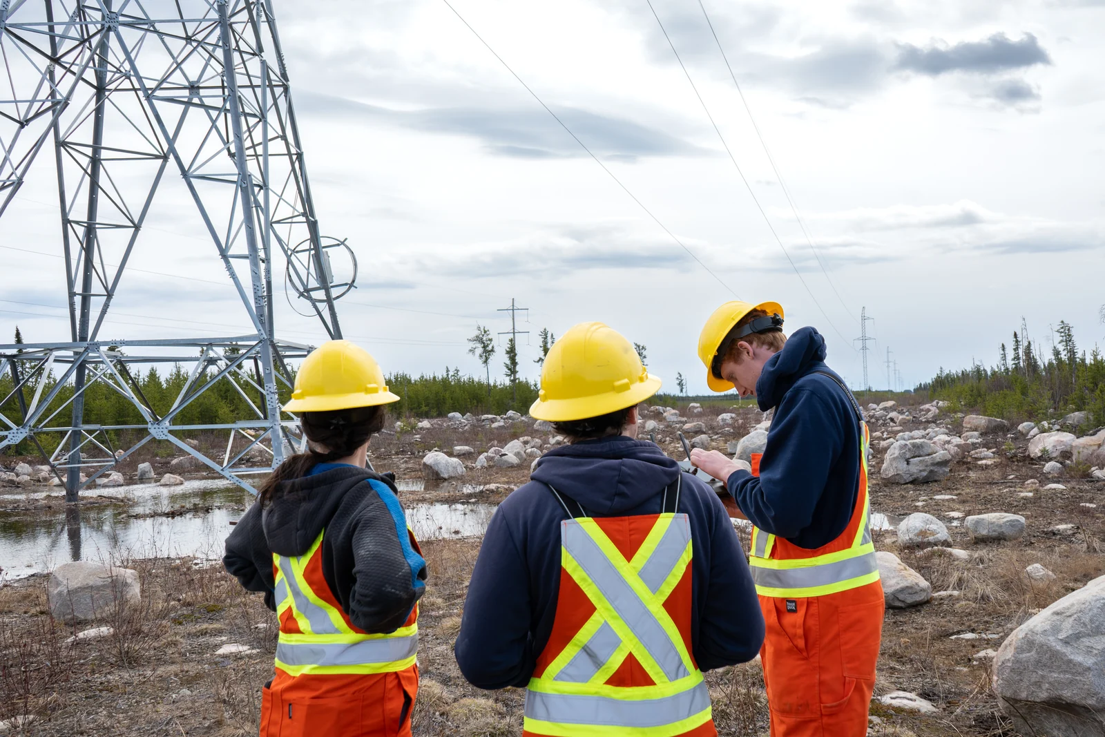
QA before demobilization: checking frames at the structure costs a re-shoot, not a re-mobilization. Detect field photography
What should a Canadian utility require from drone contractors?
Gates for the first two tiers and an outcome for the third. Without a national imagery standard, the utility's specification and acceptance criteria carry the data requirement; useful public references include the IEEE 1936.13-2026 recommended practice for image collection on overhead distribution lines and EPRI's drone imagery guidance with example shot sheets.
- Match the certificate to the operation. Advanced for sheltered, near-people or controlled-airspace work; Level 1 Complex and an RPAS Operator Certificate for BVLOS corridors; currency within 24 months.
- Prequalify the operator. Insurance, a documented safety program and the contractor prequalification your utility already runs.
- Adopt one capture standard per structure type. Shot sheets with required angles and a camera-settings floor, the same for every contractor.
- Require a flown verification per pilot before the first billable structure, with the imagery reviewed against the standard.
- Put QA before demobilization in the contract. Frames checked against the shot sheet on site, so a gap costs a re-shoot, not a re-mobilization.
- Grade at ingest. Assessability and structure association checked when imagery arrives; rejects go back before analysis starts.
"Each pilot shall hold a valid Transport Canada pilot certificate for the category of operation flown, current within 24 months, and shall complete a flown verification against the Utility's capture standard before the first billable structure. Imagery shall meet the shot sheet for each structure type and shall be checked on site before demobilization. The Utility may reject imagery that is not assessable or not associated with the correct structure."
Written that way, the requirement names an outcome rather than a vendor, and any program that can demonstrate it qualifies. Detect's Decision-Grade Photo Standard sets out what assessable means image by image.
The bottom line
In Canada, the certificate makes a pilot legal and the operator certificate makes a company accountable. Neither makes two crews' imagery comparable. That takes a capture standard, a flown verification and acceptance criteria the utility writes into the contract - and once they are in place, a certified pilot becomes a consistent one.
Fly utility inspection work to one standard
Drone service providers and pilots in Canada can apply to the Detect Partner Network. The Data Quality Program is free at every step and flown with any quadcopter.
Apply to the Partner Network →Utility team? Book a demo